
spans multi-environment GNSS platforms, 3D LiDAR data acquisition, land, sea, and aerial surveying systems, machine control solutions, precision agriculture technologies, unmanned navigation, robotics, and real-time GNSS infrastructure.
Founded in 2003, CHCNAV has focused on making advanced technology both efficient and accessible, delivering solutions that combine high performance, reliability, ease of use, and affordability. Through continuous investment in research and development,
we drive innovation in proprietary software, algorithms, and core hardware to ensure accuracy, scalability, and long-term value.
With more than 2,000 employees and a global network of regional offices and distributors, CHCNAV supports professionals in over 140 countries. As the needs of spatial data and automation continue to grow, we remain committed to advancing navigation, positioning and mapping technologies that enable smarter, faster, and more efficient operations.
Budapest, Europe 1097
Hungary
Gallery
AlphaAir 10: A Combined Lidar & RGB System
CHCNAV Unveils X500 and Redefines Pro Drone
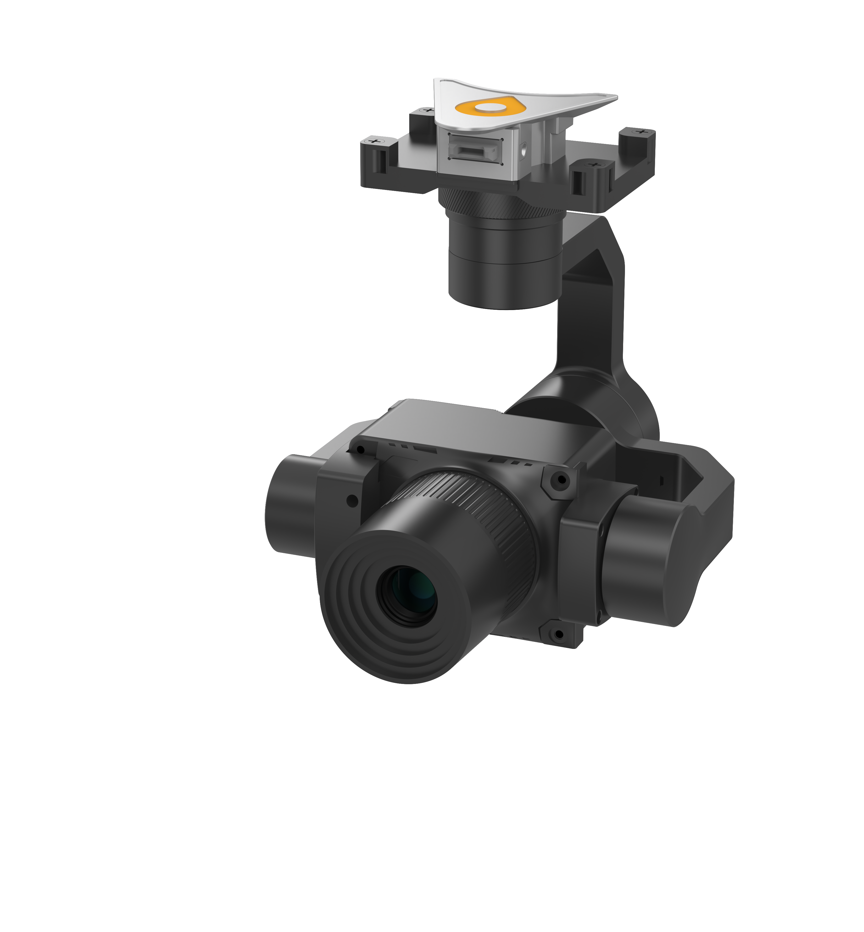
CHCNAV C504
Videos
The AlphaAir 10 (or AA10) is an advanced aerial surveying solution that seamlessly integrates LiDAR and RGB sensors to meet the needs of professional UAV LiDAR mapping and drone photogrammetry. Precision and Advanced Scanning Capabilities The AlphaAir 10’s (or AA10) high-precision navigation algorithm, in conjunction with the CHCNAV scanner, provides 5 mm repeated range accuracy and achieves ...
The CHCNAV X500 rotor UAV is a professional drone engineered for exceptional payload capacity and endurance. Equipped with advanced flight controls and high-precision positioning, it delivers superior maneuverability, stability, and flight performance. Its built-in visual SLAM and obstacle detection radar ensure intelligent, safe operations. Compatible with CHCNAV sensors and third-party ...